The Cavan Way: Ireland's Shortest National Waymarked Way
The River Shannon is Ireland’s longest river, and if you ask most people where it starts, you will get a shrug. The honest answer is a small, perfectly circular pool of black water tucked under a limestone cliff on the Cavan–Fermanagh border, in a field you would drive past without a second look if you did not know to stop. It is called the Shannon Pot, and the trail that runs past it — and past a great deal else worth seeing — is the shortest of Ireland’s National Waymarked Ways.
The Cavan Way covers just 26 km, linking the villages of Dowra and Blacklion through the drumlin and lakeland country of County Cavan. Most people who have heard of Cavan at all think of it as the flat, unglamorous county you drive through on the way somewhere else. Walk even half of this trail and that opinion will not survive the day.
What the Cavan Way actually is
At 26 km, the Cavan Way is the shortest of Ireland’s National Waymarked Ways — short enough to walk in a single long day if you are fit, or, more sensibly, to spread comfortably over two. It is waymarked throughout with the standard yellow arrow and figure, graded Moderate rather than Easy, since a handful of short climbs and some genuinely remote, boggy stretches keep it from being a stroll.
It runs between Dowra, a small village where the counties of Cavan, Leitrim and Fermanagh very nearly meet, and Blacklion, a border village that sits directly across a stream from Belcoo in County Fermanagh. Walk it in either direction and you get the same trail; most guides describe it Dowra to Blacklion, which also happens to put the Shannon Pot near the start rather than the end, and we think that is the right way round for a first-timer — you want that particular discovery early, not as an afterthought once you are tired.
The route: drumlins, lakes, and the source of a great river
Leaving Dowra, the trail climbs steadily onto the uplands above the Shannon’s infant valley, and within the first few kilometres you reach the Shannon Pot itself — a short signposted detour off the main line that nobody who has come this far should skip. It is a strange, quiet place: a spring-fed pool, said locally to be bottomless, from which Ireland’s 360 km main river begins its journey to the Atlantic at Limerick. Stand there for a minute and it is hard not to feel it.
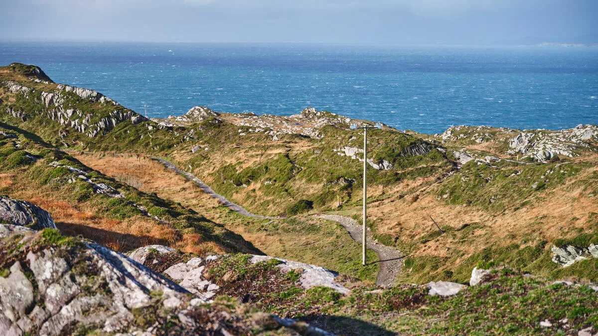
From the Pot, the Cavan Way climbs onto open moorland and blanket bog, the most remote and exposed section of the whole route, before dropping down through forestry and farmland into classic Cavan drumlin country — the low, rounded hills left behind by the last Ice Age, packed so closely together that the county has more lakes per square kilometre than almost anywhere else in Ireland. The trail threads between several of them, including Lough Macnean, which straddles the Cavan–Fermanagh border and gives the walk some of its best views: water, reed beds, and drumlins rolling away in every direction.
The final stretch runs down into Blacklion itself, a small border village with a pub or two and, a short walk across the bridge, the twin village of Belcoo on the Northern Ireland side — a nice reminder that this whole route sits in genuinely liminal country, geographically and historically.
A landscape with a long memory
The Cavan Way is short, but it is not thin on history. For much of its length it runs close to the line of the Black Pig’s Dyke, a linear earthwork of banks and ditches that once ran for many kilometres across the Cavan–Fermanagh–Monaghan borderlands. Archaeologists date parts of it to the Iron Age, and local tradition has long linked it to the old boundary defences of Ulster in the sagas — the same mythic landscape as the Táin Bó Cúailnge, Ireland’s great cattle-raid epic, whose action plays out a little further east around the Cooley Peninsula. Whether or not the Dyke is quite as old or as purposeful as the stories suggest, walking alongside a earthwork that people were already telling legends about a thousand years ago is a fairly unusual way to spend an afternoon.
The lakes carry their own history. Several hold small islands with the remains of early monastic settlements — places chosen, as so often in early Christian Ireland, for their isolation rather than their convenience. You will also pass court tombs and other megalithic remains scattered through the drumlins, unmarked and unfenced, exactly the way most of rural Cavan’s archaeology has always been: there, if you know to look.
Practicalities: difficulty, timing, and getting there
Most walkers cover the Cavan Way in one long day (allow seven to eight hours if you are stopping for the Shannon Pot detour and lunch) or, better, split it comfortably over two, overnighting in Dowra or Blacklion. As a single-day add-on to a longer trip through the northern midlands or south Ulster, it is close to ideal — genuinely varied terrain, real history, and a proper sense of remoteness, without needing more than a day out of your itinerary.
Waymarking is generally good but this is quiet, low-traffic country; do not expect passing walkers to check on you, and do not rely on a phone signal across the boggier sections. OSI Discovery map sheet 26 covers the route. Public transport to either end is limited — Dowra and Blacklion are both small villages well off the main road network — so most people arrive by car, or as part of a longer walk connecting to the Leitrim Way at the Dowra end or the wider Ulster Way network on the Fermanagh side. Spring and autumn are the kindest seasons; the open moorland section can be genuinely wet and heavy going after sustained rain.
Where the Cavan Way fits
We will say plainly what the strategy behind this whole series says about the Cavan Way: it is too short, and this corner of Ireland too quiet on transport and accommodation, for us to build a supported self-guided holiday around it on its own. We do not currently offer a tour here, and we are not going to pretend otherwise.
What we do have is a lot of experience walking the northern midlands and south Ulster borderlands, and a fair number of enquiries from people who want to see this part of Ireland — the lakes of Cavan and Leitrim, the Marble Arch Caves country around Fermanagh, the quieter side of the border — stitched into something longer and properly supported. If that sounds like you, get in touch and tell us what you have in mind. We are always happy to talk through a tailor-made route, even for trails we do not sell off the shelf.
For the wider picture, our guide to Ireland’s National Waymarked Ways covers every trail in the network, including the eight we do offer as fully supported holidays. And if the mythology of the Black Pig’s Dyke has whetted your appetite, our guide to the Táin Way follows the story properly, through the Cooley Peninsula where the cattle raid itself takes place.
Frequently Asked Questions
How long is the Cavan Way?
The Cavan Way is 26 km long, making it the shortest of Ireland’s National Waymarked Ways. It links the villages of Dowra and Blacklion in County Cavan.
How many days does the Cavan Way take?
Most walkers complete it in one long day or split it over two. As a single, well-varied day out it is one of the most manageable National Waymarked Ways in the country.
Where does the Shannon actually start?
At the Shannon Pot, a spring-fed pool near Dowra just off the main line of the Cavan Way. It is the traditional and widely accepted source of the River Shannon, Ireland’s longest river, which runs 360 km from here to the Atlantic at Limerick.
Is the Cavan Way difficult?
It is graded Moderate rather than Easy. There is no serious mountain terrain, but the open moorland and blanket bog section between the Shannon Pot and the descent towards Blacklion is exposed and can be heavy going underfoot, particularly after rain.
What is the Black Pig’s Dyke?
An ancient linear earthwork of banks and ditches running through the Cavan–Fermanagh–Monaghan borderlands, parts of which date to the Iron Age. Local tradition connects it to the old defensive boundaries of Ulster described in early Irish sagas, in the same mythic landscape as the Táin Bó Cúailnge.
Does Walking Holiday Ireland offer a tour on the Cavan Way?
Not at present. There is too little accommodation and transport infrastructure at either end to build a supported self-guided holiday on this trail alone. We are happy to talk about a tailor-made route through the wider Cavan, Leitrim and Fermanagh lakelands — just get in touch.
What maps do I need for the Cavan Way?
OSI Discovery Series map sheet 26 covers the full route, including the Shannon Pot detour.